Go to the centre of the earth in the Western Region! The Western Region is quite a big place, with a lot to do and to see. One of the most well known peninsulas is here. This one has the, presumably, most photographed mountain in all of Iceland, Mount Kirkjufell. The name of the peninsula is The Snæfellsnes peninsula. In this region, you can also have a culinary shark meat tasting, without the Brennivín though. You can enjoy some natural hot pools with some history and enjoy the beautiful surroundings and try to see some whales.
Snæfellsnes peninsula
There is a lot to do in the Snæfellsnes peninsula. You can easily fill 2 or 3 days here and have a comfortable trip. The big mountain, that forms the round part of the peninsula, is called the Snæfellsnes. You might recognise this name if you have read the book To the center of the Earth, by Jules Verne. This is the crater in which they descend. The journey on Iceland started from the town of Stapi, I read that as Arnarstapi.
Arnarstapi & Hellnar
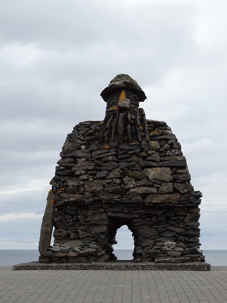
This town is home to the statue of Bárður Snæfellsás, the half troll and protector of the Snæfellnes. If you walk past the impressive stone statue, you go towards the cliff’s edge. If you take the left path, you can see Gatklettur. A wild rock formation in at the sea. And these formations keep going as you can walk over the stone bridge. During the nesting seasons, many fulmar and kitwakes. If you would continue this path, it will lead you to the Arnarstapi harbour. The right path will lead you alongside the cliffs for a while and give you a beautiful ocean view. If you continue on the 574 the next town would be Hellnar. At the end of this town you will find the Hellnar cliff points. These have gorgeous wild rock in wild slamming waves. There are multiple accommodation and restaurant options in both Hellnar and Arnarstapi.
Djúpalónssandur & Dritvik
Djúpalónssandur is a beach that consists of two beaches. The first one, the one you start on, is Djúpalónssandur. This is a sandy to rocky beach with scattered parts of the founded Epine GY7 Fishing Trawler Brotajárn togarans. The English ship hit the rocks in 1948 and all 14 members of the crew unfortunately died. The wreckage of the ship is still visible on this beach. It has two tidal pools, with one the size of a small lake, Djúpalónssandur lagoon. Besides the fact that this is a beautiful beach with a history, it is also special in another way. It has an Elvish church. You have to look a bit for the correct rock formation, but there is one, and you have to treat it with respect, of course.
Drivik
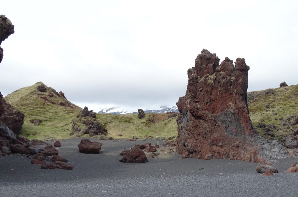
The beach in the extension of Djúpalónssandur is called Dritvik. You can walk around the cliffs if you are sure that it is low tide, and stays like that for a while. Otherwise, there is a path on the cliffs you can follow. We took about 15–20 minutes to get there. This beach is a bit different, I noticed instantly. The beach is made of big smooth pebbles and sometimes even smooth rocks. It is covered in fish remains, which is kind of cool if you are into anatomy. It also had a lot of washed up kelp, (boat) floats and buoys. On the left side of the beach, when you arrive at the beach, are some big basalt structures. These are not that stable and are crumbling into sharp pieces.
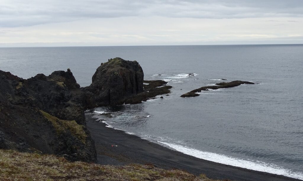
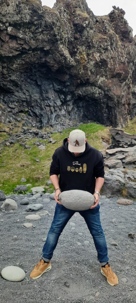
In this area there is a troll church. On the right side is another rock formation which is called Bárðars’ boat. In this area there is also a mysterious hidden labyrinth. You walk back over the lavafield back to Djúpalónssandur. On your way back to the parking lot you should try out the fisherman’s ancient lifting stones, just to see if you are/were a worthy fisher.
Ólafsvík
On the coastline of the peninsula is a village called Ólafsvík. It is a nice town with a few accommodation options and gas stations. At the back of the town is a waterfall named Bæjarfoss, which means townfalls. If you are in the area and want to do some whale watching, this is the spot. In the harbour of Ólafsvík is Lákitours, with whom you can book a tour.
Ölkelduvatn Mineral Spring
Have you ever had sparkling water out of a natural source? If you haven’t, this is your change. Next to a farm, a little of the main road there is the Ölkelduvatn Mineral Spring. The water has been tested and appears to be very healthy and safe to drink. If you want, you can fill your waterbottle for a few ISK, so bring some cash. I am not sure if I liked the taste, but hey, I am still alive and well!
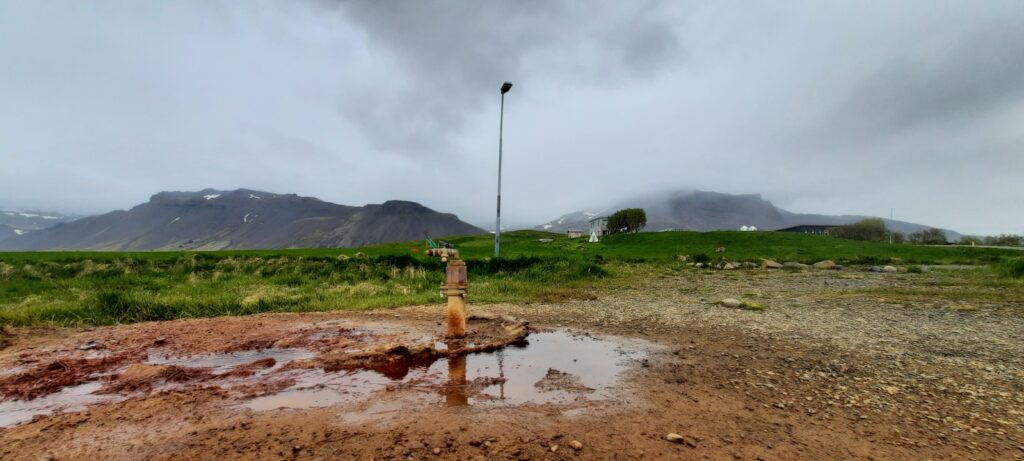
If your interest in this peninsula has been sparked, and you want to know more? Then here is a map with a few good spots to put on your wish to visit spots.
Bæjarfoss in Ólafsvík is a waterfall in town, hence the name towns fall. Its height is probably between 30-40 meters. It is easy accessible even from the town of Ólafsvík.
Bæjarfoss, Ólafsvík, Snæfellsbær, Western Region, 355, Iceland
Grundarfoss is a waterfall, a bit hidden, on the Snaefellsnes peninsula near Grundarfjörður. The waterfall is 70 meters high and its water is from the river Grundara. The Snaefellsjokull glacier is responsible for the water of the river, so the volume of water is a bit depending on the season. The water has, over the years, carved out a bowl at the base of the waterfall. A hidden treasure on the peninsula.
Grundarfoss, Grundarfjarðarbær, Western Region, 350, Iceland
Rjómafoss is a waterfall for which you need to hike a bit. There is not a road leading to it. It is a two-step waterfall which, in pictures, looks quite beautiful.
Rjomafoss, Snæfellsbær, Western Region, Iceland
Svöðufoss is a relatively small waterfall. It is 10 meters high and falls in 1 big fall and a small cascade. There is a parking lot nearby, so walking up to the fall takes about half an hour, depending on the weather and how fast you walk.
Svöðufoss, Snæfellsbær, Western Region, Iceland
Bjarnarfoss is a waterfall in the river Landakotsgil which falls from the mountain Mælifell. The fall is about 79 meters high and falls in two parts. Sometimes the upper part of the waterfall gets blown away by the wind and the last part of the stream trickles down. The waterfall can be visited and also seen from the road and from the grounds of the Búðakirkja.
Bjarnarfoss, Snæfellsbær, Western Region, Iceland
The Bjarnarhöfn shark Museum is a lovely local museum with an impressive beachcomber and taxidermy collection. They know a lot about the history and are happy to tell you all about it. You can have a Hákarl tasting with and/or without Icelandic Rúgbrauð. Behind the museum is the dry house where you can find the newest batch.
Learn all about the history and the proces of Hákarl.
Bjarnarhöfn Museum, Bjarnarhöfn, Sveitarfélagið Stykkishólmur, Western Region, Iceland
Kirkjufellsfoss is an easy accessible waterfall. You have to pay for the parking, and they check your license plate with camera’s. There is a little path to the pond underneath Kirkjufellsfoss, but half way this path you have a beautiful sight of the waterfall with mount Kirkjufell on the background.
The water from Kirkjufellsfoss is the river Kirkjufellsá. The fall consists of 3 smaller waterfalls next to each other. Together they form Kirkjufellsfoss.
Kirkjufellsfoss, Snæfellsnesvegur, Grundarfjarðarbær, Western Region, 350, Iceland
Mount Kirkjufell (church mountain) is probably the most photographed mountain of Iceland. Kirkjufell is 463 meters high. It is possible to climb it, but the climb is a dangerous one. People have slipped and didn’t live to tell the tale. As you drive towards and around the mountain, the shape changes. There it is possible to do kajak tours in the bay next to Mount Kirkjufell, which seems an amazing midnight sun activity.
The mountain is not only a pretty thing to see, but geologically also very interesting. Kirkjufell is composed of volcanic rock, but it is not a volcano. Instead, it is a nunatak, a type of mountain that stood above the surrounding glaciers during the Ice Age. Before that, it was part of the area’s strata, which consists of alternating layers of Pleistocene lava and sandstone, with tuff at the summit.
Kirkjufell, Grundarfjarðarbær, Western Region, 350, Iceland
Ólafsvík is a town on the north coast of the peninsula. The town has a few beautiful pieces of wall art. There is a waterfall in the back of the town against the mountains. In Ólafsvík you can book a Whale Watching Tour with Láki tours, who are very successful in this area. It is also a good spot to stay before continuing your travels.
Ólafsvík, Snæfellsbær, Western Region, 355, Iceland
The Saxhóll crater is about 100 meters high. The walk to the rim is not that bad because there is a well-maintained staircase with 390 steps. The crater itself is not that deep, and maybe not even that impressive, but the view is amazing! The Saxhóll crater was formed somewhere between 3000-4000 years old. There is a parking lot directly next to the staircase, which makes it really accessible.
Saxhóll, Snæfellsbær, Western Region, Iceland
Djúpalónssandur is a beach naturally divided into two different beaches. One of them is Djúpalónssandur and the other one is Drítvík. The legend has it that the first one has an Elfish church and the second one a Trolls church. The first beach is a sandy beach with small grains and here and there a pebble. The second beach is made up of big pebbles and rounded rocks, filled with fish remains and drift wood. On Djúpalónssandur you can find the remains of an English Epine GY7 Fishing Trawler Brotajárn togarans. It stranded in 1948, and unfortunately all the crew members died.
It is a magical place, whether you believe in Elfs and Trolls or not. There is even a hidden labyrinth somewhere on the lava field between the ruins of old houses.
Djúpalónssandur, Snæfellsbær, Western Region, Iceland
The Vatnshellir cave is a lava tube which was formed about 8000 years ago. It belongs to the Purkhólar crater, and the volcano to which this tube belongs is only 500 meters away. You will enter the cave by using a spiral staircase going down, and it will almost take you to the center of the earth, almost underneath the Snæfellsjökull. Just like Jules Vernes To the Center of the Earth. The tour will take about 45 minutes and is relatively easy to do.
Vatnshellir, Útnesvegur, Arnarstapi, Hellissandur, Snæfellsbær, Western Region, 360, Iceland
Lóndrangar (Lóndrangar útsýnisstaður) is two volcanic columns growing out of the ocean. The two columns are 61 and 75 meters tall and old volcanic plugs. But most of the people visiting Lóndrangar don’t come for the geology. They come for the birds. It is a good birdwatching spot with chances to see puffins and many more of course.
Lóndrangar, Útnesvegur, Arnarstapi, Hellissandur, Snæfellsbær, Western Region, 360, Iceland
Hellnar is a town near Arnarstapi. It used to be a very important fishersvillage. You can enjoy the beautiful coastline, and it is a good place to spot the Northern Lights. If you want, you can walk along the coastline all the way up to Arnarstapi and back. On this walk you can enjoy the wild basalt and volcanic rocks and formations.
Hellnar, Snæfellsbær, Western Region, Iceland
The town of Arnarstapi is a ”famous” town. I think it was used in the book To the Center of the Earth by Jules Verne. The characters in the book start their journey to the Snæfellsjökull out of this town. In the town of Arnarstapi you can find the stone statue of Bárður Snæfellsás. You can also find a lot of birds around the cliffs, beautiful Fulmars and Kittiwakes. You can walk along the coastline towards the harbour and then go back. Have a delicious meal at the Arnarbær restaurant. Or walk towards Hellnar along the basalt/volcanic coastline.
Arnarstapi, Snæfellsbær, Western Region, Iceland
The Sönghellir cave is a quick stop along the way. From the parking it is a short walk, about 15 minutes, up to the cave. It is known for the good acoustics. There are supposed to be more caves in the area. If you are in the cave, you can overlook Arnarstapi in the distance. It is the most well known of the six ”singing” caves of Iceland, which makes it a must stop on your journey.
Sönghellir, Jökulhálsleið, Ólafsvík, Snæfellsbær, Western Region, 355, Iceland
Rauðfeldsgjá Gorge, or Red-cloak Rift, is a ravine that you can enter. There is a parking lot, but you still have to walk up a bit. For your own safety, check the SafeTravel app before you go in. After the winter there could be a thick layer of snow on top of the Gorge. When temperatures get warmer, ice will melt and can come down when you least expect. If nature allows, you can walk and ”climb” in the Gorge. It is supposed to be a very adventurous activity. There is a small waterfall, which is the point where most people stop. But if you have the right equipment and are willing to get your feet wet, you can continue further.
Rauðfeldur Ravine, Rauðfeldsgjá, Snæfellsbær, Western Region, Iceland
Búðakirkja is a black and white wooden church. The original church was built in 1703, but the current church was built in 1848. It is mostly known for being a gorgeous picture. The black and white church with the Snæfellsjökull in the background and green lava fields between them. The view is amazing. It is possible to book your wedding here or go to a mass. The church is not always open for visiting. Go visit their website for more information.
Búðakirkja, Klettsgata, Miðhús, Snæfellsbær, Western Region, 356, Iceland
If you drive from Búðir towards Arnarstapi you will see a large lava field on your left. This lava field is named Búðahraun. In the Búðahraun is the crater of the volcano that created the lava field. This crater is named Búðaklettur.
Búðaklettur is 88 meters high. You can walk a hike from Búðakirkja and you can walk all the way up and over the edge of the rim. It is said that there is a cave in Búðaklettur which leads to the Surtshellir cave. It is also said that the cave to Surtshellir is paved with gold. Even if it’s not true, you can find a variety of plants in the area, even very rare ones.
Búðaklettur, Snæfellsbær, Western Region, Iceland
Ytri-Tunga has a ”permanent” seal colony which you can visit. The walk is about 10 minutes from the parking lot towards the coastline. Seals are wildlife, so there is never a guarantee that you will see them. Also, this beach is not of black sand, but golden sand. So that’s nice for a change of view.
Ytri-Tunga, Snæfellsbær, Western Region, Iceland
Silver Circle
Just like the Southern Region and the Northeastern Region, the Western region has a highlighted circle. This one is named, The Silver Circle. The shape is not really a circle but you have to keep an open mind for this one. The Silver Circle actually ”only consist” of a few steps, so I added a few steps so you don’t miss them. I would recommend doing this circle in 2 or 3 days, depending if you want to do the tour stops as well. It has a bit of everything, a thermal spa, waterfalls, lava tube and a glacier. What more could you wish for.
The Víðgelmir cave is a Lava tunnel which originates back to 900AD when the volcano nearby erupted. The lava flow took between 100 – 150 years to calm down. You can visit it by booking a tour. This tour will take you 700 meters into the tunnel, which is more than a kilometer long. The cave has multiple different lava formations, like Lava roses and the really fragile stalactites. This cave also has cave-bacteria which give a silver sparkle when you shine light on them. The cave is protected by the troll named Hallmundur. But, you can only see him in the correct lightfall.
Víðgelmir, Víðgelmisvegur, Borgarbyggð, Western Region, Iceland
Into the glacier will bring you towards the heart of the Langjokull Glacier. They say that they are the world’s largest Ice tunnel. You can visit the tunnel throughout the entire year. Special vehicles will take you up to the ice tunnel. The duration of the drive is about 30 minutes in the summer and about 75 minutes in the winter. You will have about an hour in the tunnel when you arrive.
Into the Glacier, Borgarbyggð, Western Region, Iceland
The original Húsafellskirkja has been replaced with a new one. The new one was built in 1973. Between 1710-1803 there was a reverend in the church named Snorri Björnsson. Snorri was a very strong man and people believed that he was a sorcerer. He was known for exercising ghosts. According to the stories, it is believed that he exercised 18 ghosts who were sent by his enemies. Near the church is a circle which has 18 stones. 18 stones for 18 ghosts.
Reverend Snorri has a descendend named Páll. Who has made a lot of beautiful art, face carving in rocks, and you can see these in Húsafell. A lot of the face carvings can be seen all around Iceland.
Húsafellskirkja, Borgarbyggð, Western Region, 320, Iceland
The town of Húsafell is at the foot of the Eiríksjökull and Langjökull and covers about 100 square kilometers. There is a lot to do in the surrounding area, like visiting Barnafoss and Hraunfossar. But you can also plan excursions outside of Húsafell, like Into the Glacier and The Húsafell Canyon Baths. There is also the legend that the Bæjargil ravine has a ghost. And if you are into ghost stories, visit the Húsafellkirkja and read the story of reverend Snorri Björnsson. Húsafell has a lot of accommodation options, like guesthouses, a hotel and a camping ground.
Húsafell, Borgarbyggð, Western Region, Iceland
Barnafoss means Children’s Waterfall and comes from an old legend. In the past, a natural bridge would have crossed it. Two children allegedly tried to cross it but slipped, fell and drowned in the wild water below. The mother was so torn by grief that she would have destroyed the bridge.
Now there is still a small natural bridge above the swirling waters, but it is not allowed and will not be easily commissioned. A wooden bridge has been built to go over it so you can see the water flowing beneath you and set foot on the lava field for a moment. The water flows into the Hvítá (White River).
Barnafoss is not a big waterfall, if you can even call it a waterfall. It is more of a series of rapids that go through a narrow pathway of the vulcanic rocks of the lava field. It is an easy walk, and you can park your car at the parking lot of Hraunfossar.
Barnafoss, Borgarbyggð, Western Region, Iceland
Hraunfossar flows into the Hvítá (White River) and is about 900 meters long, up to 12 meters high and leaves the lava field Hallmundarhraun from middle to bottom via several streams. Because of the high calcium content in the water, it turns blue or sometimes even almost approaching mint green. The colors stand out beautifully against the dark lava rock.
You can park really close-by, and the walk is really easy. If you go over the bridge you can even set foot on the lavafield (Hallmundarhraun).
Hraunfossar, Borgarbyggð, Western Region, Iceland
On the edge of Reykholt is the pool Snorralaug. This is a historial site, which means that you are not allowed to swim in it. The pool is named after the 13th century poet Snorri Sturluson. The pool was near his ground and he had a tunnel leading from his home to the pool. You are allowed to explore the tunnel.
Snorralaug, Hótel Reykholt, Reykholt, Borgarbyggð, Western Region, Iceland
Reykholt is not a very big town, but offers a more traditional experience. You can find Snorralaug, Snorri’s pool, here just like the Snorrastofa museum. You can also visit the beautiful church, Reykholtskirkja. And nature wise, wild horses roam the area, so you could be able to spot them while you are in the area. And because it is a small remote community, with very little light polution, it is a great area to try and spot the Northern Lights during the darker months.
Also, every July they have the Reykholt festival, which is an international chamber music festival.
Reykholt, Borgarbyggð, Western Region, Iceland
Krauma hot springs is located next to the Deildartunguhver hot spring, which is the most powerfull hot spring in Europe. Krauma has 6 baths, 5 hot ones and one cold. They do not need to use chemicals to keep the pools clean because the water keeps refreshing in a natural way. Next to the hot springs, there is a relaxation room and sauna. They also have a restaurant which offers local food.
Krauma, Deildartunga, Deildartunga 2, Borgarbyggð, Western Region, Iceland
Deildartunguhver is the most powerful hot spring in Europe, volume wise. It produces 180 liters of water per second at a temperature of almost 100°C. It used to be the hottest river, from which the water flows freely. But now, they use the water for heating the houses in Borgarnes and Akranes. They do this with pipelines. Next to the spring is a greenhouse in which, among other things, tomatoes are grown. There is a foodtruck next to it called Staldrið Food Truck. Here you can get good food like a really good hot dog and tomato soup. You can enjoy the food in the greenhouse.
You can also find a specific type of fern here. This species can only be found in Iceland and is called the double-leaved fern (Blechnum spicant var fallax).
Deildartunguhver, Víðigerði, Deildartunga 2, Borgarbyggð, Western Region, Iceland
Natural hot tubs, bath like a Viking
Everyone needs some relaxing time every once in a while. In the Western Region, you have a few options to relax. If you drive north you will pass the gorgeous mountain Esjan, which is a mineral-rich place and available for hiking. Going around Esjan will lead you to Hvammsvík hotsprings. Hvammsvík hotsprings are multiple hotsprings at different temperatures. There is a steambath, outdoor showers and the Atlantic Ocean is near, so if you feel the need to really cool down between warm baths.
If you are looking for a more exclusive experience, try out the Húsafell Canyon baths and bath like a Viking. The baths are in a canyon between two old volcanoes, but this is still the heat source for the hot springs. You will be driven there by a guide who can get you a drink while you’re soaking the pools. If you feel adventurous, you can take a dip in the cold stream. This is melting water from the nearby glaciers, and probably around 2 degrees.
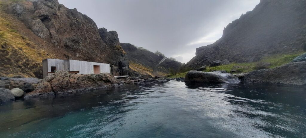
If you want to stay in the Viking vibe, you can visit Eiríksstaðir, a Viking longhouse. This is a replica of a Viking long which was found on the same grounds. It was made with the help of archaeologists and can be visited with a guided tour.
For the foodies
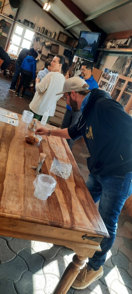
If you are like me, and want to try different types of local or locally produced food, there are at least two different places you should visit. The first one is also a museum, the Bjarnarhöfn Shark Museum. Here you can learn about the history behind the famous fermented shark meat. Included in the admission is a shark meat tasting, which is highly recommended. You can’t get it fresher than here. The second spot I would recommend is the Erpsstaðir Creamery. This is a beautiful farm with a shop that presents home-made products like cheese, meat products, ice cream and Skyr. You can enjoy some delicious food, if you are lucky, in the sun while looking at the farm animals. After that, you can continue your journey, maybe with some snacks for later.
Waterfalls
Of course, there are numerous waterfalls in this region. Some of them are easier to find and or to reach than others. I personally liked Lísafoss a lot because of the beautiful surroundings and the crystal-filled river bed.
If you are interested in other waterfalls or would like to learn more about the other regions of Iceland, checked out my other pages.

