It covers most of the areas in Iceland, around 24,256 km2. Suðurland starts a few kilometers eastern of Kálfafell and ends at the east end of Reykjanesfólkvangur. In this region you can find Katla Geopark, Þórsmörk, a big part of the Highlands and Gullni hringurinn (The Golden circle). The area has a lot of ”sleeping” volcanoes which are past their due time.
Sneak preview of Iceland
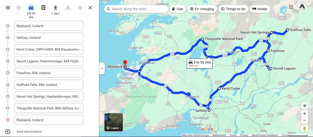
A lot of people who visit Iceland for the first time, or visit for a short amount of time, will visit Gullni hringurinn of The Golden Circle. It almost starts if you drive out of Reykjavík and you can drive it both ways. I would recommend, if you have the time, to do the circle in two days. Do most of the stops on day 1 and do Þhingvellir National Park on the second and take your time. In the Circle are a few stops that will give you a little taste of what Iceland can offer.
Gullni hringurinn
The Golden Circle is about 270 km when you start and end in Reykjavík. Along the route, you can find different spots to stop and enjoy the beauty of Iceland. For example, you will pass the Kerið crater, a hot spring and multiple waterfalls. You can start or end your circle in Þhingvellir National Park, which is the oldest parliament in Iceland. Check out the map to see where the spots along the Golden Circle are.
Silfra Diving, Valhallarvegur, Bláskógabyggð, Southern Region, Iceland
Öxarárfoss is the waterfall in Þingvellir. Depending on where the tourbusses stop, most people from the tours don’t go to this waterfall. If you drive towards P5 you can already see the waterfall in the background. The walking trail from the visitors center is 1,7km and takes 25 minutes. Öxarárfoss is 14 meters high and the width depends on how much water comes down. The width varies between the 5-10 meters and 26,5 meters. But most of the time it is in the 5 to 10-meter range.
Öxarárfoss, Efrivallavegur, Bláskógabyggð, Southern Region, Iceland
Öxarárfoss, Efrivallavegur, Bláskógabyggð, Southern Region, Iceland
Laugarvatn is a lake near Þingvellir National Park. It also has a town with the same name. This town is surrounded by lava fields and a planted forest. In the lake live fish like Char and Cod, but you need a permit to fish here. There is also The Fontana Spa which is built around a thermal hot spring. So a good spot to relax during your travels around the Golden Circle.
Laugarvatn, Bláskógabyggð, Southern Region, Iceland
You can either start or end with Þingvellir National Park. I would recommend doing this on its own day so you can enjoy it to the fullest. From 930 till 1798 the alÞing, the annual parliament, was held here. In 1881 the new parliament opened in Reykjavík in the Alþingishúsið.
Þingvellir is on the Mid-Atlantic ridge, which means that you can walk between the cracks of an open breaking continental plate, the North American. When you walk in the valley, you actually walk on a microplate (Hreppafleki) between the two continents. The second plate is the Eurasian plate, but this wall is a few kilometers out.
You can even dive or do some snorkeling at Silfra. This is at the edge of Þingvallavatn, which is the biggest natural lake in Iceland. The water is one of the clearest in the world with visibility of 80–100 meters deep if Silfra was that deep.
You can visit the visitorscenter as well and check out the museum about the history of Þingvellir and the geology of the area.
Þingvellir National Park, Bláskógabyggð, Southern Region, Iceland
Geysir is actually the name of the big geyser that is not that active. The most active one is Strokkur. This one goes every 4–8 minutes and can blow up to 15–20 meters high. Its water is about 120 degrees and the depth of this one is 23 meters deep. Geysir is just a few meters away and rarely active, unfortunately. They are both in a geothermal active area in which you can have a relaxing stroll between the sulfur fumes. The water in this area is sometimes almost crystal blue, which colours beautifully against the yellowish surrounding rocks.
Geysir, Biskupstungnabraut, Bláskógabyggð, Southern Region, Iceland
Gullfoss is one of the most famous waterfalls of Iceland. The name Gullfoss means Golden Waterfall and is in the Golden Circle. It falls in two steps and is 32 meters high. Gullfoss is in the river Hvítá which flows through a beautiful canyon. You can take the easy road and walk along the top side of the waterfall or take the walk down and walk up to the roaring stream. If you do the last, you will probably be sprayed with waterfallmist.
Gulfoss Panorama, Gullfoss, Bláskógabyggð, Southern Region, 806, Iceland
Selfoss is like the capital of the southern region. You wil pass through it if you take the 1 to do the full circle or if you do the Golden Circle. It is a lovely town with beautiful houses and lots of cafés and shops.
Selfoss, Sveitarfélagið Árborg, Southern Region, 800, Iceland
Gamla Laugin is presumed to be the oldest natural hot water spring(swimming pool) in Iceland. It is a little of the Golden Circle but some tour include it. If you go without a tour, it comes in handy if you prebook your visit. It was established in 1891 at Hverahólmi. The water stays between 38-40 degrees the entire year.
Secret Lagoon, Hveramýri, Hvammur, Fludir, Hrunamannahreppur, Southern Region, 845, Iceland
Faxifoss is a smaller waterfall on the Golden Circel. But because most people either do a Golden Circle tour or only do the big stops, this one is often missed. You do have to pay for parking. This waterfall is in the Tungufljót river and is 7 meters high. It has a salmon stairs, which is not used very often.
Faxafoss, Faxavegur, Bláskógabyggð, Southern Region, Iceland
The Kerið Crater is a 6500-year-old crater. You can walk on the caldera and descend into the crater and walk around the crater’s lake. You have to pay to park and visit. Kerið is the result of an explosive eruption. It has a very deep hole which is now filled with rubble. The crater is later filled with water, being rainwater and maybe some groundwater as well.
Kerið Crater, Biskupstungnabraut, Grímsnes- og Grafningshreppur, Southern Region, 805, Iceland
Museum
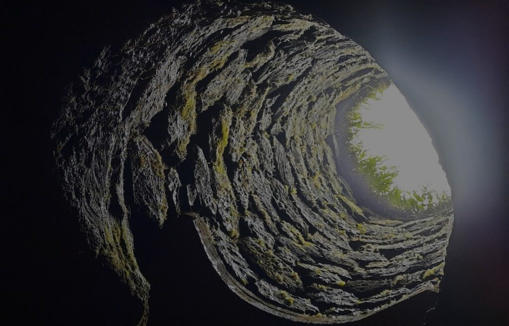
A stop worth the visit is one in Hella. Near the unpredictable volcano named Hekla is a mysterious area with a nearly unplacable, in history, caves. The Caves of Hella. This very interesting museum will guide you through 3 of the 12 known caves. We had a superb guide who knows a lot about the area and the presumable history behind these caves.
Hálendið – Highlands
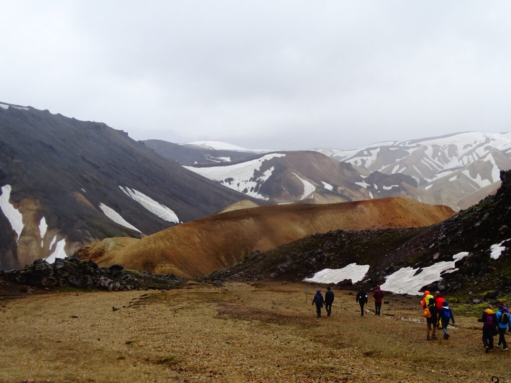
A big part in the centre of Iceland is called the Highlands. This is the area in the middle of the island which is above the 300 – 400 meters. It is mostly uninhabitable, but mostly a beautiful area to hikers. You can visit most of the Highlands only in the summer months, around the middle-late June till late September, depending on the weather. In this area you can, for example, find Landmannalaugar. This beautiful area is known for its coloured mountains and has multiple hiking trails. The road to is, leading from Hella, is a 4X4 and has multiple rivercrossings. If you are not sure if you or the car can handle these roads, I would recommend a hiking tour with a 4×4 bus pick up from Reykjavík or Hella. It is really worth the visit, you even pass by Rauðaskál (The Apple Crater).
Þórsmörk
Some of the hiking trails leading out of Landmannalaugar can take you to the other side of the valley, to the area called Þórsmörk. You can also drive to this place taking the road next to Seljalandsfoss, 249 switching to the F249. We haven’t reached this place, because of rivercrossings, last time but hopefully we will see this valley the next time. There are a few different tours you can book if you want to see it but not drive yourself.
Waterfalls
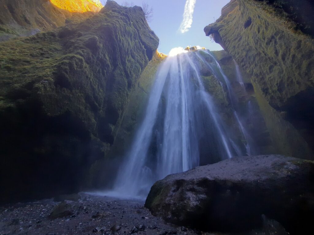
There are a few waterfalls in Suðurland worth the visit. Some of them are real tourist attractions. Like Seljalandsfoss and Skógafoss. But they are worth the visit. If you park at Seljalandsfoss, you can take the short walking trail up to Gljufrabui, which is a short gorge with a waterfall at the end of it. And if you are able to drive a bit further, you can take the 249 and find Nauthúsagil on your right side. It is a bit more adventurous than Gljufrabui and you might need dry socks after it. If you would drive along the 1 further, you can find Skógafoss on your left side. Skógafoss is approachable from the river level and via a hike also from the top. A little bit further in the same area you can find Kvernufoss, which is a smaller lesser known waterfall similar to Seljalandsfoss. The bustours do not stop here, so it is likely to be less crowded. If you want to know more about the waterfalls of Iceland, you can check out this page with the waterfalls that I have visited.
Katla Geopark
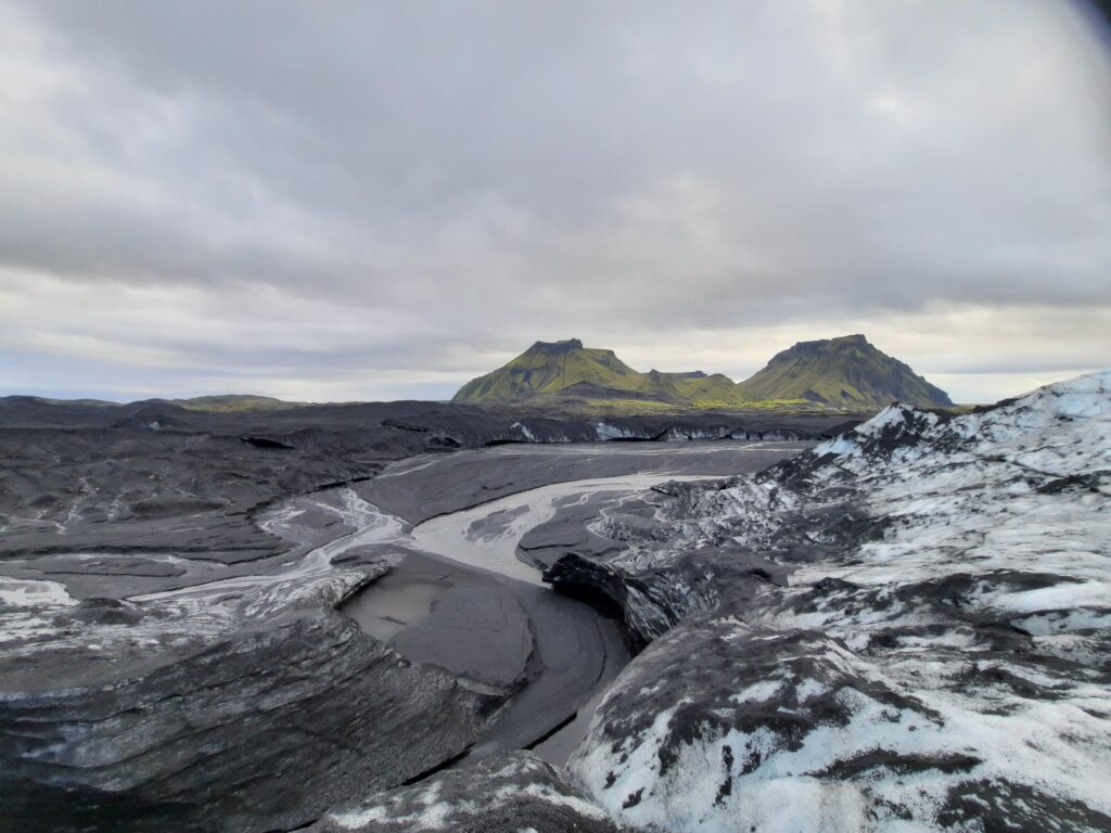
If you drive further along the south coast you will pass by Vík. This is a lovely town next to the ”famous Black Sand Beach”. Near Vík you can also find Dyrhólaey, good for bird spotting, and maybe the most dangerous beach in the world, Reynisfjara. If you go to that beach, respect the signs and the lights. People drown and disappear here every year. Next to Vík is the famous volcano, the Katla. There is a really good series on Netflix called Katla. Check it out before you go. You can visit Katla’s Ice caves throughout the whole year, unlike most of the ice caves. Do this which a guide. They know best where it is safe to go. There is one going out from Vík with a 4X4 superjeep. When you come back you can enjoy soup in black bread (super jummie) and then enjoy the Lava show with ”lava” from the Katla. It is al the same building.
Star Wars Fans
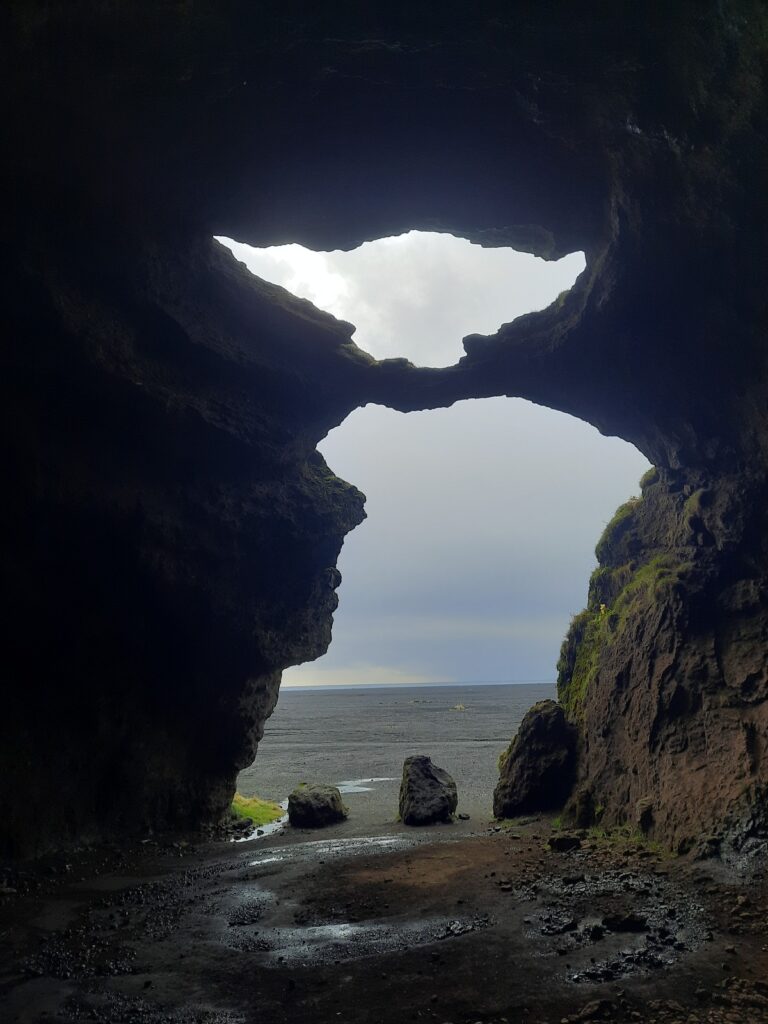
Are you a Star Wars fan? Then you should check out Gígjagjá. If you can’t find it, and you want to ask the locals, tell them this name. This cave is also known under the name Yoda Cave. This is because of its unusual resemblance to Master Yoda. It was used in Star Wars Rogue one. It is one of the biggest caves they used in Iceland, and it has a great shape for producing echoing sounds. The cave is now in Viking Park and you need to pay to park. When you are there, there is also a Viking grave on top of the hill. I haven’t visited it yet due to bad weather.
Mossy Lava fields
If you drive further over the 1 you will pass through an immense lava field. This is from the last Katla eruption in 1918. This specific type of moss has overgrown the lava rocks and makes it look like they are covered in velvet. I can imagine trolls walking through this landscape in the dark. If you go in the early summer months, June-July, you can see the Arctic Lupins flowering as well. This gives the green/grey velvet a slightly purple hue.
Do you want to know more about this region? Don’t hesitate to send me a message, and do you want a vacation made to your wishes, let me know.

